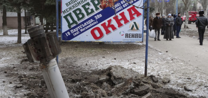
Armament Research Services (ARES) is delighted to announce the second instalment in our field guide series, Introduction to Photogrammetry: Using perspective analysis to infer the trajectory of incoming munitions. Released yesterday, this Field Guide is intended to familiarise readers with the use of perspective analysis in conflict zones. It introduces and explains key concepts central to performing perspective analysis, including how to locate and work with vanishing points, estimation of dimensions, working with geospatial data, and even some introductory explanation and demonstration of reverse perspective projection.
From the Guide:
…the nearest hole in the ceiling and the hole in the floor are assumed to have been caused by a cargo rocket. Under that premise, the photograph potentially contains information pointing towards the launch site of this rocket, which would be along a line drawn in the horizontal direction between the centre of the hole in the floor and the centre of the nearest hole in the ceiling. It is of interest to extract this information, as it could help determine which party to the conflict perpetrated the attack. However, it is clearly not a case of just using rulers overlaid on the image to estimate a direction. Instead, in order to take measurements from a photograph (with a view to determining directions), it is necessary to account for distortions caused by perspective. Perspective analysis is a way to handle this.
To read the full publication, click here.
For more publications from ARES, see our Publications page.

